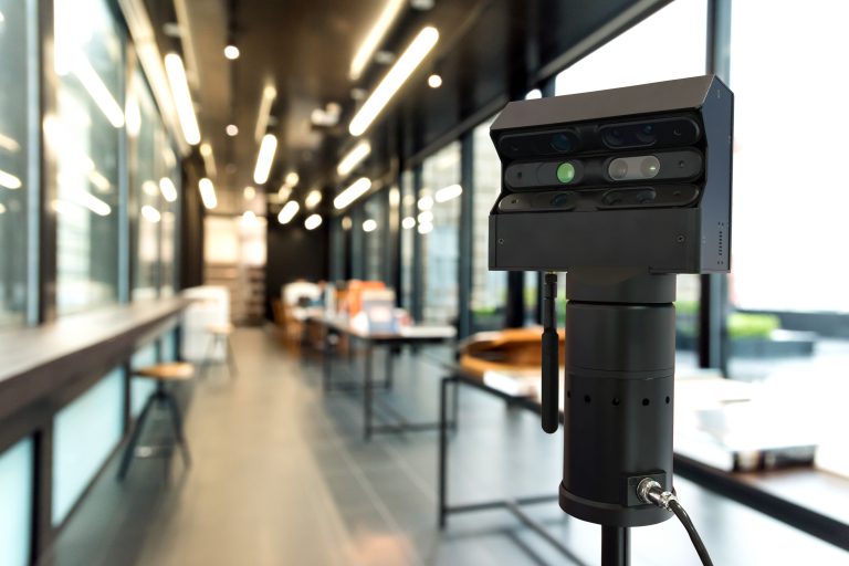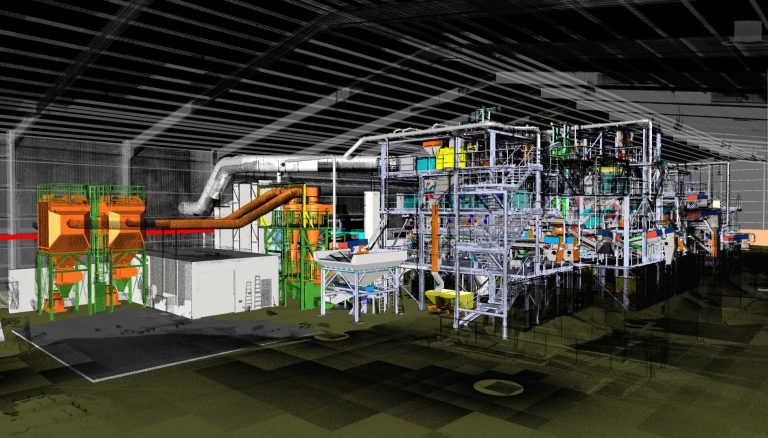

Point Cloud Scanning has been touted as the “next big thing” in engineering and construction and allows you to accurately map, measure and visualise complex 3D environments. The scanner, alongside producing accurate point clouds of data, also produces black and white and colour HDR scans and photographs which can be accurately measured or traced over to produce 2D CAD plans and elevations
But why should you use it and what are the benefits? Here are our top 7 reasons for using 3D Point Cloud Scanning on your next project.
1. It saves you time and money
We understand you’ve important project deadlines to meet and that’s why Point Cloud Scanning could be just what you need. Fewer man-hours are spent carrying out traditional measurement surveys and our FARO Focus scanner takes just two minutes to set up.
Further, and due to the quality and quantity of the data captured with Point Cloud Scanning, it’s much easier to plan schedules and there’s no need to return to the scanned location numerous times, which will save not only more man-hours but travel expenditure too.
2. It provides you with greater access to sites
Due to our Point Cloud Scanner’s ability to scan up to 330m away, it allows you much better access to hard-to-reach locations. Consider damaged plants or offshore platforms – our 3D scanning services provide a quick and simple solution to situations that may normally seem complex.
3. It reduces risk
Point Cloud Scanning allows you to play out various orientations, scenarios and layouts of a project in a virtual (CAD) environment. You can therefore be certain of the best solution before beginning the delivery of your project, whilst improving planning and scheduling thanks to precise and reliable data.
Also, the speed of Point Cloud Scanning means that HSE risks associated with exposure to potentially dangerous areas is significantly reduced.
4. It minimises disruption
Because our scanner is compact and takes a fraction of the time it would take to carry out a traditional measured survey, it means less disruption to the working environment. Work can continue as normal whilst our experts work unobtrusively to scan the environment around you.
5. It increases accuracy and reduces errors
Point Cloud Scanning eliminates a great deal of ‘user errors’ that could result from a traditional survey. The model created then provides you with a ‘live’ point of reference that can be accessed, revisited and referred to as frequently as required and it’s easy to identify differences between project and as-built data.
6. It helps with compliance control
The accuracy of Point Cloud Scanning means that it can help principals, design engineers and build contractors to deliver consistently and in line with BIM models, standards and guidelines.
7. It increases collaboration
The digital scans, data and drawings created through Point Cloud Scanning can efficiently be sent to your project partners via file sharing tools throughout the duration of your project. And, our FARO scanner also directly processes data with all of today’s most commonly used CAD programmes.

Want to know how Point Cloud Scanning could help with your next surveying, planning and/or CAD project? Get in touch with us today.
Benefits of Apprenticeships
Apprenticeships have long been prevalent in the engineering industry but have grown in popularity in all areas in recent years – maybe owing to the introduction of the Apprenticeship Levy in 2017. According to UCAS, there are now approximately 1500 different job role...
10 Predictions For Engineering Recruitment In 2020
The end of one decade marks a period of reflection, but it also provides a reason to look ahead. British engineering has undergone considerable change in the last 10 years. From the decline in oil and gas production to the arrival of BIM, CAD and 3D printing,...
It’s not too late to get IR35 ready
The changes to IR35 legislation come into effect in just a number of weeks now. Do you feel like you're not yet prepared? Don't worry - there's still time to get ready. And even better, we're here to help!You'll know by now that the responsibility for deciding whether...


